 |
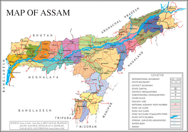
| Agroclimatic Zones of Assam |
1. North Bank Plains
Districts: Darrang, Sonitpur, Lakhimpur, Dhemaji, Biswanath
Net Cropped Area: 536598 hectares
Cropping Intensity: 163&
2. Upper Brahmaputra Valley
Districts: Golaghat, Jorhat, Sivasagar, Dibrugarh, Tinsukia, Charaideo, Majuli
Net Cropped Area: 620320 hectares
Cropping Intensity: 131%
3. Central Brahmaputra Valley
Districts: Nagaon, Marigaon, Hojai
Net Cropped Area: 327637 hectares
Cropping Intensity: 126%
4. Lower Brahpamutra Valley
Districts: Goalpara, Dhubri, Kokrajhar, Bongaigaon, Kamrup, Nalbari, Barpeta, South Salmara-Mankachar
Net Cropped Area: 929757 hectares
Cropping Intensity: 150%
5. Barak Valley Zone
Districts: Cachar, Karimganj, Hailakandi
Net Cropped Area: 241715 hectares
Cropping Intensity: 142%
6. Hill Zone
Districts: North Cachar Hills, Karbi Anglong, West Karbi Anglong
Net Cropped Area: 154570 hectares
Cropping Intensity: 165%
Map Resource: Survey of India
